

Pass
Sele La Pass
Sele La Pass is a remote 4,290m mountain crossing connecting the northern Ghunsa Valley with Tseram and the southern Kanchenjunga region.
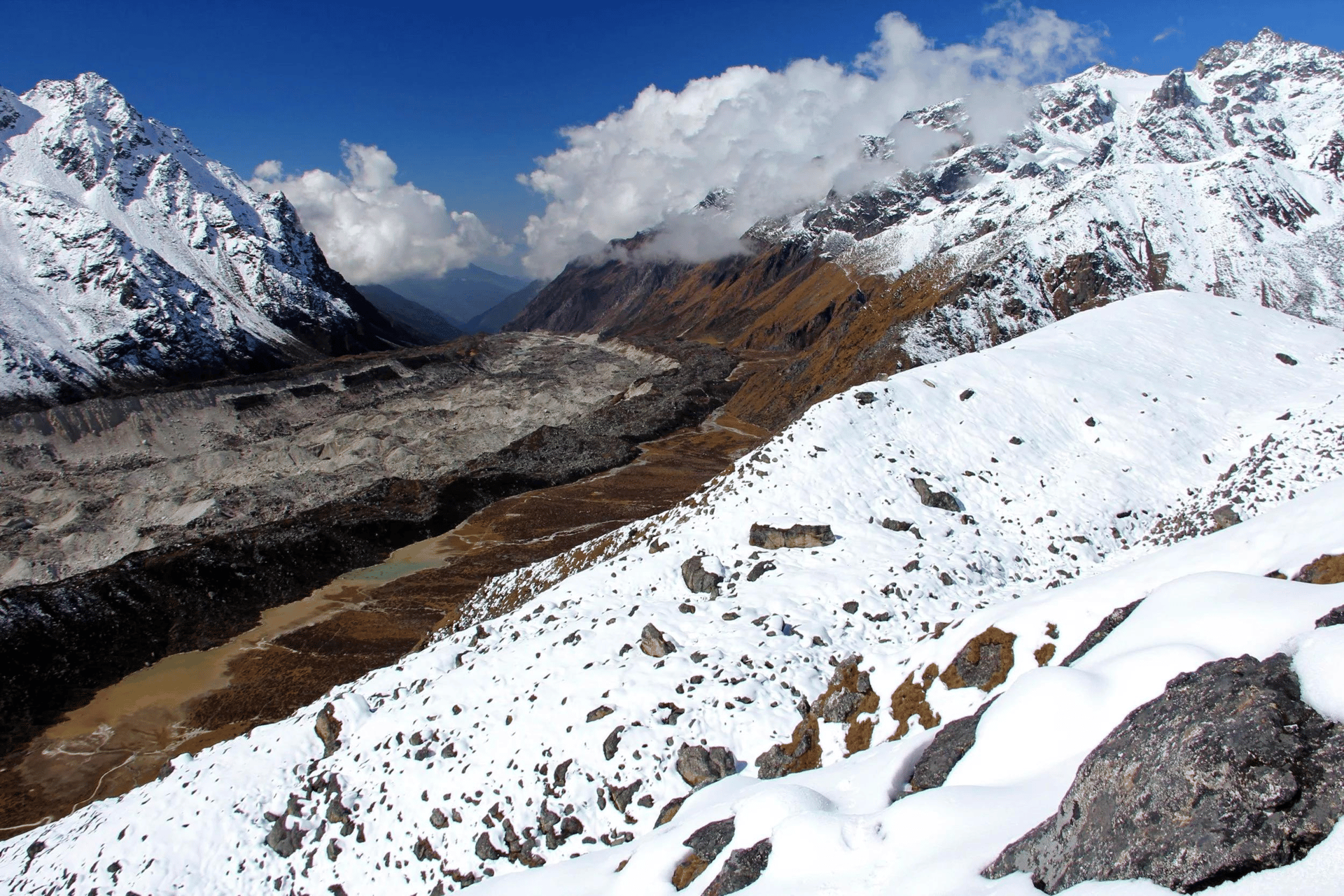
- Elevation: ~4,290 m / 14,075 ft
- Type: Mountain pass
- Region: Kanchenjunga
- District: Taplejung
- Connects: Ghunsa ↔ Tseram
- Northern Approach: Ghunsa
- Southern Approach: Tseram
- Nearby Passes: Sinion La, Mirgin La, Sinelapche Bhanjyang
Sele La Pass is one of the important high-altitude crossings on the Kanchenjunga Circuit Trek, linking the northern and southern sides of the Kanchenjunga region in eastern Nepal. The pass is commonly described at approximately 4,290 metres (14,075 feet) and forms part of the high mountain traverse between Ghunsa and Tseram.
The approach to Sele La begins after leaving Ghunsa, one of the major settlements on the northern Kanchenjunga route. From Ghunsa, the trail climbs through alpine terrain toward the Sele La area before continuing across a series of high passes and descending toward Tseram.
Sele La is not an isolated pass in the sense of being the only high point on this section. The broader crossing includes several mountain passes and ridgelines, including Sinion La, Mirgin La and Sinelapche Bhanjyang. On the standard circuit, these crossings create a demanding high-altitude day between the northern and southern valleys.
The landscape changes significantly as the trail gains elevation. Forests gradually disappear and are replaced by open alpine slopes, rocky ridges and exposed high-altitude terrain. Depending on the season, snow can cover parts of the route, and weather conditions can change rapidly.
One of the attractions of the Sele La crossing is the panoramic mountain scenery. On clear days, trekkers can see across the surrounding Himalayan ranges, with views toward Kanchenjunga, Jannu and other major peaks. The high ridgeline also provides views down toward the valleys on both sides of the circuit.
After crossing the high passes, the trail descends toward Tseram, at approximately 3,870 m. This descent marks the transition from the northern Kanchenjunga landscape toward the southern Yalung Valley and the route to Ramche and Oktang.
Sele La is therefore an important geographical point on the Kanchenjunga Circuit rather than simply another trekking stop. Crossing this high mountain section allows trekkers to connect the two major sides of the Kanchenjunga region without retracing the same route.
Sele La Pass Trekking Information
- Elevation: Approx. 4,290 m / 14,075 ft
- Location: Kanchenjunga Region, Taplejung, eastern Nepal
- Region: Kanchenjunga Conservation Area
- Route: Ghunsa → Sele La area → Tseram
- Northern Side: Ghunsa
- Southern Side: Tseram / Simbua Khola Valley
- Nearby Passes: Sinion La, Mirgin La, Sinelapche Bhanjyang
- Terrain: Alpine slopes, ridges, rocky and potentially snow-covered sections
- Main Trek: Kanchenjunga Circuit Trek
- Difficulty: Strenuous high-altitude crossing
- Accommodation: No permanent lodging at the pass
- Best Seasons: Spring and autumn
- Altitude Consideration: Proper acclimatization is important
Crossing Sele La
The Sele La section is generally started early because the route involves sustained high-altitude walking and several passes before the descent toward Tseram. Current route descriptions put the crossing from Sele Le to Tseram at roughly 11–13 km and around 8–9 hours, although actual distance and duration vary with the precise trail and conditions.
The crossing is one of the defining sections of the Kanchenjunga Circuit because it physically connects the northern and southern trekking corridors. After descending to Tseram, trekkers can continue toward the Yalung Glacier, Ramche and Oktang, completing the southern side of the Kanchenjunga journey.
Nearby places

Checkpoint
Ghunsa -The Heart of the Kanchenjunga Region
Ghunsa
3,400 m
Ghunsa is one of the most strategically important stops on the Kanchenjunga Circuit Trek. Its elevation of around 3,400 m makes it an ideal acclimatization point before trekkers ascend toward Kambachen, Lhonak, and Pangpema.
Read place