Village
Kambachen, Kanchenjunga
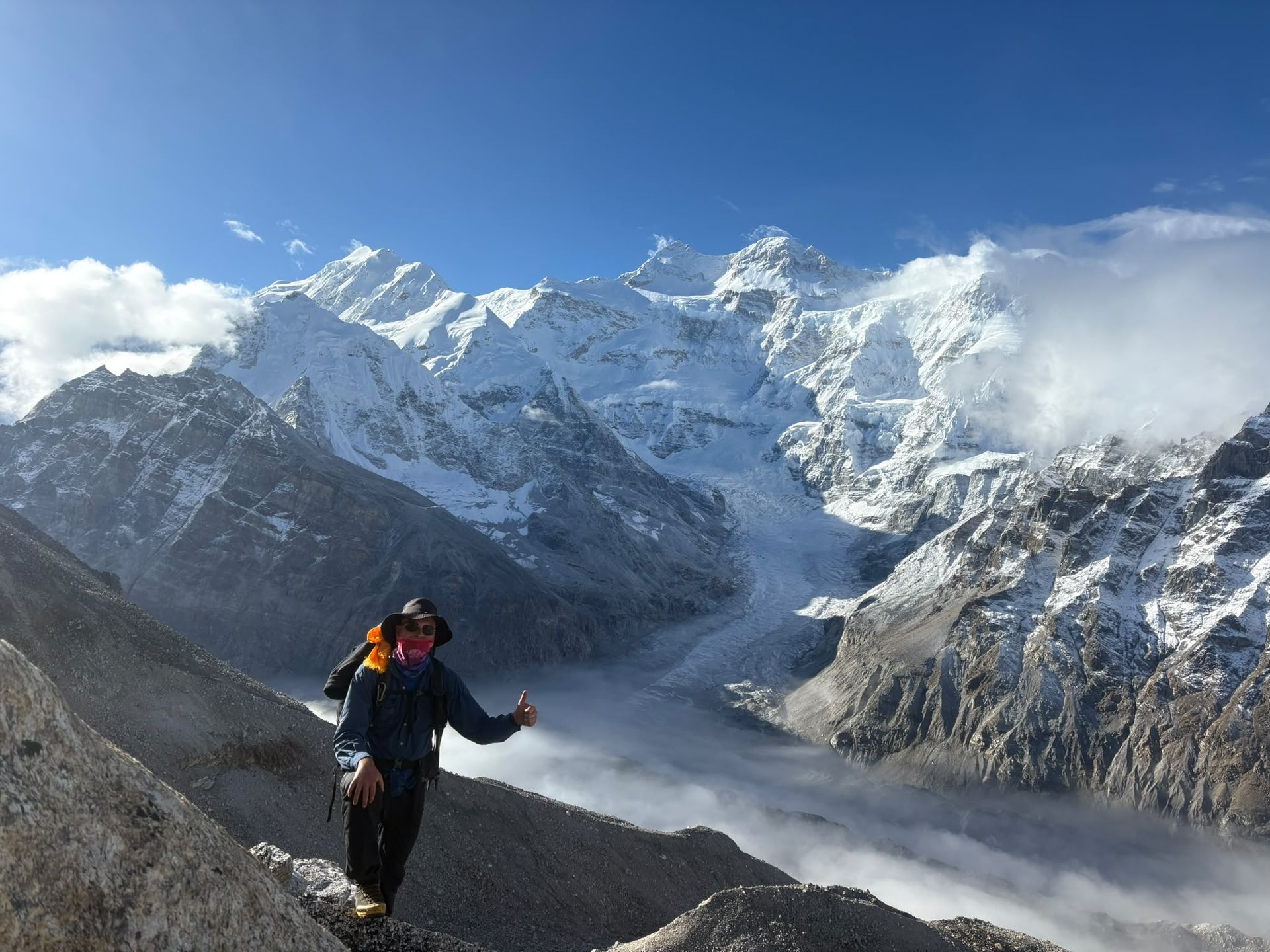
Kambachen at 4,145 m is a remote high-altitude settlement on the Kanchenjunga North Base Camp route, surrounded by dramatic alpine landscapes and views toward Jannu.
- Elevation: 4,050 m / 13,287 ft
- Location: Kanchenjunga Conservation Area, Taplejung, Nepal
- Route: Ghunsa → Kambachen → Lhonak
- Trek from Ghunsa: Approximately 5–6 hours
Kambachen is a remote high-altitude settlement in the upper Kanchenjunga region of eastern Nepal, situated at approximately 4,145 metres (13,599 feet). It lies along the northern approach to Kanchenjunga North Base Camp, between Ghunsa and Lhonak, and is one of the most important overnight stops on the journey toward Pangpema.
The trek to Kambachen from Ghunsa marks a dramatic change in the landscape. As the trail climbs higher along the Ghunsa Khola, dense forests gradually give way to open alpine terrain, rocky slopes, glacial streams and increasingly dramatic mountain scenery. The journey is approximately 10–12 km and commonly takes around 5–6 hours, although walking time varies with trail conditions and the pace of the trekking group.
Kambachen is particularly notable for its proximity to Jannu (Kumbhakarna), a spectacular 7,000-metre-class peak whose imposing mountain walls dominate parts of the surrounding landscape. The settlement itself is small and remote, with basic mountain accommodation suited to trekkers travelling deeper into the Kanchenjunga wilderness.
For many trekkers, Kambachen represents an important transition point before entering the even higher and more rugged terrain toward Lhonak and Pangpema. Some itineraries include an additional acclimatization period here, while others continue to Lhonak after an overnight stay.
The remote character of Kambachen is one of its greatest attractions. There are fewer facilities than in Ghunsa, and the environment becomes increasingly exposed and alpine. Trekkers should therefore follow their guide's advice, maintain a steady pace, stay hydrated and allow sufficient time for acclimatization.
From Kambachen, the trail continues north toward Lhonak, following increasingly barren and glacial terrain before reaching the Pangpema area and the spectacular northern face of Mount Kanchenjunga.
Kambachen Trekking Information
- Elevation: 4,145 m / 13,599 ft
- Location: Kanchenjunga Conservation Area, Taplejung, eastern Nepal
- Route: Ghunsa → Kambachen → Lhonak
- Typical walk from Ghunsa: 5–6 hours
- Approximate distance from Ghunsa: 10–12 km
- Accommodation: Basic mountain lodge/tea house
- Landscape: Alpine valley, rocky slopes, glaciers and high Himalayan peaks
- Major nearby destination: Lhonak and Pangpema, Kanchenjunga North Base Camp
Kambachen is more than simply a place to spend the night. It is one of the points where the Kanchenjunga trek begins to feel truly high-altitude and remote, offering trekkers a memorable introduction to the dramatic landscapes surrounding the world's third-highest mountain.
Nearby places

Checkpoint
Yamphudin – Gateway to Southern Kanchenjunga
Yamphudin
2,080 m
Yamphudin, at around 2,080 m, is a remote mountain village in Taplejung and an important stop on the southern Kanchenjunga trekking route. Surrounded by forests, farmland and mountain valleys, it offers trekkers a glimpse of the region’s diverse culture and traditional Himalayan lifestyle.
Read place
Village
Lhonak - Last Settlement Beneath Kanchenjunga
Lhonak – Last Settlement Beneath Kanchenjunga
4,780 m
Lhonak is more than a stop on the Kanchenjunga trek—it is the final high-altitude staging point before Pangpema, the North Base Camp. At around 4,780–4,790 m, trekkers are already in a demanding glacial environment, with very limited facilities and exposed terrain.
Read place
Village
Pangpema - Kanchenjunga North Base Camp
5,140 m
Pangpema, at around 5,140 m, is the northern base camp area of Mount Kanchenjunga. Reached from Lhonak through rugged glacial terrain, it offers spectacular views of Kanchenjunga’s northern face, glaciers and surrounding Himalayan peaks. Proper acclimatization is essential at this altitude.
Read place
Checkpoint
Ghunsa -The Heart of the Kanchenjunga Region
Ghunsa
3,400 m
Ghunsa is one of the most strategically important stops on the Kanchenjunga Circuit Trek. Its elevation of around 3,400 m makes it an ideal acclimatization point before trekkers ascend toward Kambachen, Lhonak, and Pangpema.
Read place